Terrain Digital Twins for Ski & Bike Resorts
From static maps to living mountain intelligence
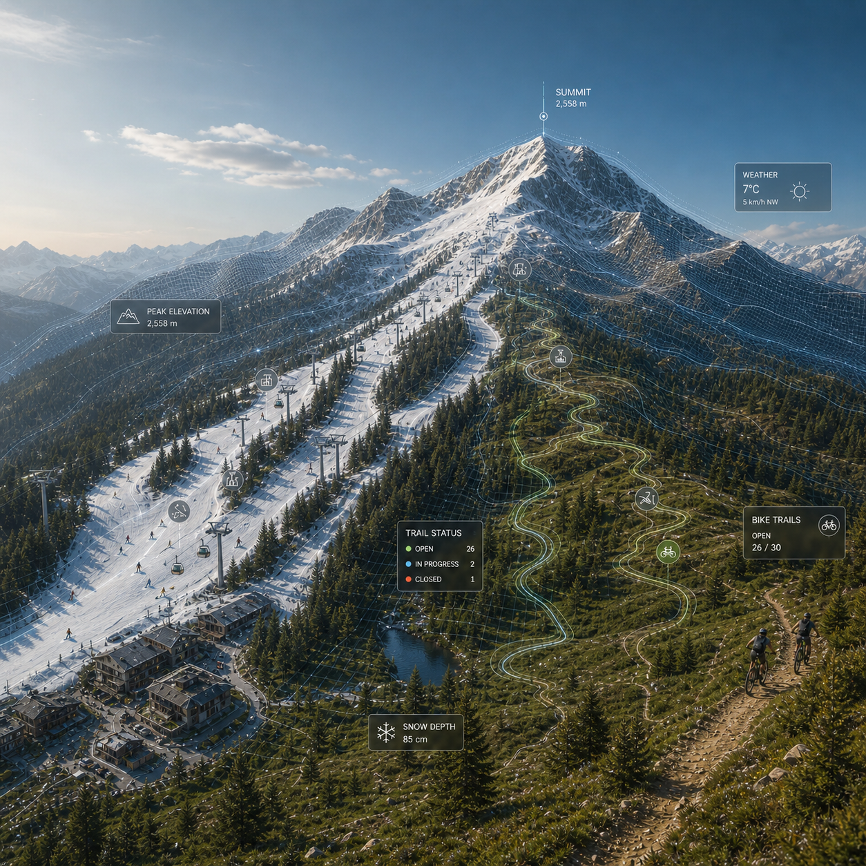
Mountain resorts operate in fast-changing environments where terrain, weather, maintenance needs, and guest movement all affect safety, efficiency, and experience. TECOLS develops terrain digital twins for ski and bike resorts that transform high-resolution geospatial data into a living digital model of the mountain. Rather than relying only on traditional trail maps or generic 3D views, resorts gain a detailed, updateable representation of terrain, trails, vegetation, infrastructure, and operational conditions.
A terrain digital twin can support both winter and summer operations from the same geospatial foundation. In winter, it can improve grooming and snowmaking planning, closure and boundary management, patrol access, and emergency routing. In summer, it can support bike trail maintenance, post-storm inspections, erosion and drainage review, trail difficulty communication, and safer guest navigation. This creates one system that helps resorts operate more efficiently across both seasons instead of treating winter and summer as completely separate challenges.
For resort guests, the value is clarity and confidence. A digital twin can support better route guidance based on terrain difficulty, trail conditions, and skill level, helping skiers, snowboarders, and riders make safer and more enjoyable decisions. Guests can better understand steepness, trail character, closures, and changing surface conditions, while resorts can provide a more modern and helpful navigation experience.
For resort teams, the value is stronger operational awareness. By combining LiDAR-based terrain data with weather inputs, resort updates, and spatial analytics, TECOLS helps create a practical decision-support platform for planning, maintenance, and risk management. Resorts can better identify problem areas, prioritize work, document changes, and improve coordination between operations, patrol, and management.
TECOLS focuses on digital twins as working tools, not just visual products. Our goal is to create systems that are accurate, useful, and scalable: from terrain mapping and geospatial analysis to integration with operational workflows and guest-facing applications. Whether the need is smarter maintenance, better safety planning, stronger summer recreation support, or a long-term digital foundation for resort growth, TECOLS helps transform mountain data into decisions.